

The Oregon Treaty of 1846: How Washington and London Stepped Back from the Brink
Expansionists rallied around a slogan demanding U.S. control to 54°40′, near the southern boundary of Russian America—but the treaty the United States and Great Britain actually signed set the boundary about 390 miles to the south. The Oregon Treaty was a careful compromise that avoided a war, while leaving the era’s hardest question, Indigenous sovereignty over the land in dispute, unaddressed in the treaty text and negotiations.
On June 15, 1846, in Washington, D.C., Secretary of State James Buchanan and British minister Richard Pakenham signed a treaty ending one of the nineteenth century’s most persistent North American boundary disputes. The agreement set the 49th parallel as the northern limit of U.S. sovereignty in the Pacific Northwest, reserved all of Vancouver Island to Britain, and protected specified British navigation and property rights. The U.S. Senate approved it, 41–14, on June 18; after ratifications were exchanged in London, President James K. Polk proclaimed the treaty on August 5.1,2
The settlement did not deliver the U.S. claim to 54°40′ that expansionists later rallied around with “Fifty-Four Forty or Fight.” It instead accepted a compromise about 390 miles south of that line—one that averted the war that expansionist rhetoric had made conceivable but did not ask the consent of the Indigenous nations whose homelands were divided on paper.3
A Boundary Left Unsettled Since 1818
The dispute the Oregon Treaty resolved was old by American standards. An 1818 convention between the United States and Great Britain had left the Pacific Northwest—stretching from the Pacific to the Rocky Mountains, from 42° north, the boundary established with Spanish claims and later Mexico, to 54°40′ near Russian America—under a joint-occupation arrangement that permitted equal economic activity and occupation by both powers while postponing the sovereignty question.
The arrangement was renewed indefinitely in 1827, terminable by either side with a year’s notice. It endured while British commercial power, especially the Hudson’s Bay Company, remained dominant and U.S. settler migration was still limited.4
That changed through the 1830s and early 1840s. American missionaries—the Whitmans among them—established missions in Cayuse and Nez Perce country, and their letters home, along with government and newspaper promotion of Oregon’s climate and soil, helped fuel a wave of American emigration. American migration to Oregon Country increased sharply in the early 1840s: in 1843, almost 900 emigrants made the overland journey, including Jesse Applegate and his extended family, part of a movement encouraged by land aspirations, economic uncertainty, promotional networks, and a growing body of trail knowledge.5
The Hudson’s Bay Company maintained extensive commercial interests across the region, while its Puget’s Sound Agricultural Company held farms and property north of the Columbia River.4 Both nations now had real populations and real property on the ground, and joint occupation was no longer a sustainable long-term arrangement for either side.
“Fifty-Four Forty or Fight”: Slogan Versus Strategy
Expansionists invoked a slogan demanding U.S. control to 54°40′, near the southern boundary of Russian America. It is tempting to read that slogan as Polk’s own campaign platform, but the record does not support that. Polk’s election reflected a broader expansionist political moment, and Oregon soon became a central test of his administration, rather than a promise he had run on directly. “Fifty-Four Forty or Fight” rose to prominence as a rallying cry after the 1844 election, pressed by expansionists in Congress and the press rather than coined by Polk himself.3
The State Department’s own historical account of the episode—part of a retired “Milestones” series the department no longer actively maintains—describes an administration that pursued the boundary question through sustained negotiation.2 The fuller picture, drawn from specialist diplomatic history, is one of calculated pressure combined with negotiation: Polk combined diplomatic pressure, including moves toward ending joint occupancy, with negotiation, and ultimately accepted a 49th-parallel compromise.6
Secretary of State James Buchanan and British minister Richard Pakenham conducted the substantive negotiations, under the direction of Polk and British Foreign Secretary Lord Aberdeen.4 Earlier, as Tyler’s secretary of state, John C. Calhoun had favored a 49th-parallel settlement; the final agreement, however, was negotiated by Buchanan and Pakenham.6
Several practical pressures pushed both sides toward compromise. The United States was simultaneously moving toward war with Mexico over Texas and the Southwest, and fighting Britain over Oregon at the same time was a strategic risk few in Polk’s cabinet actually wanted to take.7
On the British side, the Hudson’s Bay Company had moved its regional headquarters to Victoria on Vancouver Island in 1845, anticipating a loss of the Columbia River basin, and the impending repeal of the Corn Laws also altered British economic calculations, adding to the pressures favoring compromise.4 Coverage in the British press reflected this shift toward accommodation rather than confrontation.8 A boundary at the 49th parallel—already the established line east of the Rockies under earlier U.S.-British agreements—offered a face-saving, economically defensible compromise for both governments.
What the Treaty Actually Said
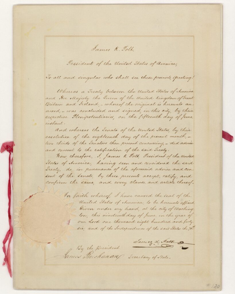
Source: National Archives, DocsTeach — Oregon Treaty, National Archives Identifier 299808 (public domain, free of known copyright restrictions)
The treaty contains five articles. Articles I–IV set out the boundary, navigation, and property terms; Article V established the ratification process. Article I establishes the boundary along the 49th parallel from the Rocky Mountains west to “the middle of the channel which separates the continent from Vancouver’s Island,” then southerly through that channel and Fuca’s Straits to the Pacific. It also kept navigation in the channel and straits south of the parallel free and open to both parties.
Article II provided a defined Columbia River navigation right for the Hudson’s Bay Company and British subjects trading with it, subject to U.S. regulations consistent with the treaty. Article III protected the “possessory rights” of the Hudson’s Bay Company and any British subjects already occupying land or property south of the new line. Article IV confirmed the Puget’s Sound Agricultural Company’s farms and property north of the Columbia, while giving the United States the option to purchase that company’s property later at a fair valuation if the government judged it of public or political importance.1
None of the treaty’s five articles mentions the Cayuse, Nez Perce, Chinook, Klickitat, or any of the dozens of other Indigenous nations whose land the treaty’s boundary line ran directly through. Neither government obtained Indigenous consent to this partition, and the treaty did not extinguish Indigenous title or resolve Indigenous sovereignty. The treaty reflects the imperial assumption that Britain and the United States could divide the region without Indigenous nations participating in the negotiations.9
Ratification and Proclamation
Polk submitted the negotiated treaty to the Senate for its advice and consent, a step his administration handled carefully given how far the final terms diverged from the expansionist rhetoric of the moment. The Senate approved the treaty by a vote of 41 to 14 on June 18, 1846, a margin wide enough to signal that most of Congress recognized the compromise as the more prudent course.2 After the exchange of ratifications in London in July, Polk proclaimed the treaty on August 5, 1846, formally establishing the international boundary.1 A later arbitration in 1872 resolved the treaty’s ambiguous water boundary in the San Juan Islands in favor of the United States.4
What the Treaty Did Not Settle
It is tempting to describe the Oregon Treaty as the moment the United States “got” Oregon, but that shorthand oversimplifies what actually happened. The treaty established U.S. sovereignty over the portion of Oregon Country south of the 49th parallel—a legal and diplomatic claim against Great Britain, the only other power the United States considered a rival claimant. It did not create a functioning territorial government; Congress organized Oregon Territory on August 14, 1848, two years later, and Oregon entered the Union as a state in 1859.4
It did not resolve Indigenous land title or sovereignty in any respect; Cayuse, Nez Perce, and other nations continued to occupy and assert authority over land the treaty had assigned, on paper, to the United States. Within little more than a year, violence at Waiilatpu exposed the unresolved conflicts that migration and U.S. expansion had intensified.
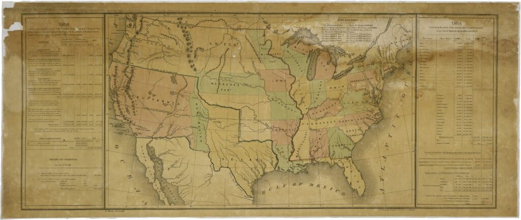
Source: National Archives, Records of the U.S. House of Representatives, Record Group 233 — “Map of the United States Including Western Territories,” National Archives Identifier 2127339 (public domain, free of known copyright restrictions)
Legacy and Civic Relevance
The Oregon Treaty offers a useful corrective to two opposite oversimplifications. It was not, as the “Fifty-Four Forty or Fight” slogan implied, a moment when the United States nearly went to war and instead won everything it wanted. And it was not, as a purely diplomatic reading might suggest, a clean and complete resolution of the Pacific Northwest’s future.
It was a narrow, carefully negotiated compromise between two governments, addressing the questions those two governments cared about—a boundary line, navigation rights, corporate property—while leaving the era’s deepest and most consequential question, the sovereignty and survival of the Indigenous nations whose land was being divided, unaddressed in the treaty text and negotiations.
Historian Walter N. Sage, writing in the Canadian Historical Review, framed the treaty as a genuinely bilateral peace settlement rather than a simple American triumph—a reading that later American textbooks, focused on Polk and Manifest Destiny, have sometimes underplayed.10
When Narcissa Whitman crossed into Oregon Country in 1836, the region remained under joint U.S.–British occupation and was home to numerous sovereign Indigenous nations. A decade later, the Oregon Treaty gave the United States internationally recognized sovereignty over Oregon Country south of the 49th parallel—a boundary settlement between two colonial powers, not a grant of unowned land—strengthening the political framework for the migration and territorial expansion already under way, while leaving Indigenous sovereignty and land claims unresolved. Read her story in our companion article, Narcissa Whitman: The Letters That Made Oregon Imaginable.
Continue exploring the Pioneer Era in our companion articles on James K. Polk and the Expansion of the United States and Jesse Applegate and the Applegate Trail.
Footnotes
- National Archives, DocsTeach, “Oregon Treaty” (National Archives Identifier 299808, Record Group 11): docsteach.org/documents/document/oregon-treaty
- U.S. Department of State, Office of the Historian, “The Oregon Territory, 1846,” part of the department’s retired “Milestones in the History of U.S. Foreign Relations” series, no longer actively maintained. history.state.gov/milestones/1830-1860/oregon-territory
- Edward A. Miles, “‘Fifty-four Forty or Fight’—An American Political Legend,” Mississippi Valley Historical Review 44, no. 2 (1957): 291–309.
- Oregon Encyclopedia, “Oregon Treaty, 1846,” by William L. Lang. oregonencyclopedia.org/articles/oregon-treaty
- Bureau of Land Management, “Basic Facts about the Oregon Trail,” National Historic Oregon Trail Interpretive Center blm.gov (Basic Facts about the Oregon Trail)
- Frederick Merk, The Oregon Question: Essays in Anglo-American Diplomacy and Politics (Cambridge, MA: Harvard University Press, 1967).
- Daniel Walker Howe, What Hath God Wrought: The Transformation of America, 1815–1848 (New York: Oxford University Press, 2007).
- Thomas C. McClintock, “British Newspapers and the Oregon Treaty of 1846,” Oregon Historical Quarterly 104, no. 1 (2003): 96–109. Used for the British press climate and its shift toward favoring compromise.
- Reginald Horsman, Race and Manifest Destiny: The Origins of American Racial Anglo-Saxonism (Cambridge, MA: Harvard University Press, 1981).
- Walter N. Sage, “The Oregon Treaty of 1846,” Canadian Historical Review. Consult via Project MUSE or an academic library for the full article.